
A screenshot of the GSI’s landscape forecast in the region.
Amid the loss of hundreds of lives in a landslide in Kerala’s Wayanad, landslides and torrential rainfall shook up northern West Bengal on Thursday, resulting in multiple road blocks on National Highway 10 and closures in Kalimpong. The latest incident corroborates data from the Geological Survey of India (GSI) and Indian Space Research Organisation (ISRO) on the region’s exceptional vulnerability to landslide-related calamities.
Traffic was shut on NH10 on Thursday, a day after it was reopened for the movement of light vehicles following a prolonged month-long closure in July. This National Highway, prone to landslides and damage due to surges in water levels in Teesta river, is considered critical in connecting Kalimpong in the State’s northern region to nearby Sikkim by road.

Places like Melli, 27 Mile, 29 Mile, Ravijhora, and Birikdara in Kalimpong experienced road closures due to landslides on Thursday. According to Kalimpong district authorities, heavy rain also slowed down operations surrounding debris removal from roads and resumption of vehicular traffic movement.
Parts of the National Highway, which were recently restored after landslides in the last two months, were again damaged under the impact of falling rubble and boulders on Thursday.
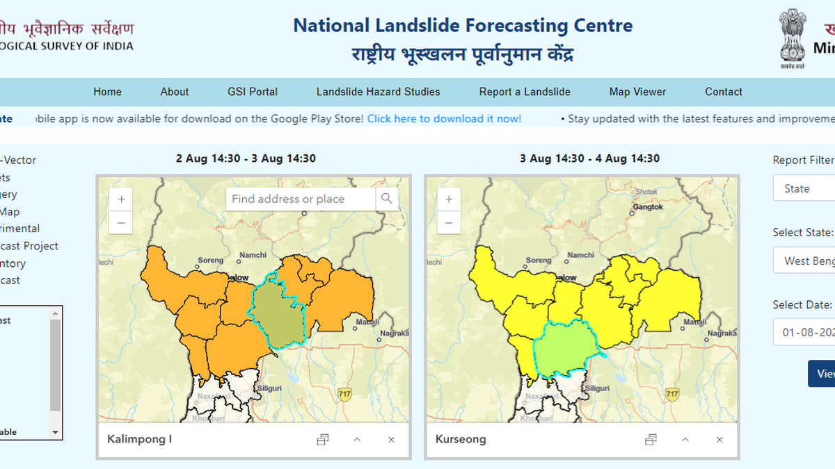
The GSI’s National Landslide Forecasting Centre has issued landslide forecasts in places across Darjeeling and Kalimpong districts with an orange (“high”) alert between Friday and Saturday and a yellow (“moderate”) alert between Saturday and Sunday, on its online portal.

Notably, of the 3,782 landslides that took place in India between 2015 and 2022, West Bengal comes second only to Kerala with a total of 376 landslides, as per GSI data. Kerala tops the list with 2,239 incidents of landslides during the given period, according to a recent reply given in Lok Sabha by Minister of State (Independent Charge) of the Ministry of Earth Sciences, Jitendra Singh.
In addition to that, ISRO’s Landslide Atlas of 2023 also ranked northern Bengal’s Darjeeling district in the 35th position among 147 districts across India for its exposure to landslides in terms of key socio-economic parameters, in the 1998-2022 period.