

New Delhi: Nepal has lodged a strong protest after India and China reopened border trade through the Lipulekh Pass this August. The move has revived Nepal’s long-standing objections over the route, which links Uttarakhand with Tibet, in the Himalayas. Kathmandu it has jurisdiction over Lipulekh, Kalapani and Limpiyadhura. New Delhi rejects the claim.
Nepal’s official map, included in its Constitution, places Limpiyadhura, Lipulekh and Kalapani within its territory. Kathmandu has asked New Delhi to stop road construction, expansion and trade in the region. It also notified China that the area belongs to it.
“The Government of Nepal has been consistently urging the Government of India not to carry out any activities such as road construction/expansion or border trade in the said area. The Government of Nepal has also apprised our friendly neighbour, China, that this area is part of Nepali territory,” Kathmandu’s foreign ministry said in an official statement.
How Did India Respond?
New Delhi dismissed the objection. The Ministry of External Affairs (MEA) said trade through Lipulekh has taken place for decades.
“Border trade between India and China through Lipulekh pass commenced in 1954 and has been going on for decades… such claims are neither justified nor based on evidence,” said MEA spokesperson Randhir Jaiswal.
Why Does Nepal Claim Lipulekh As Its Own?
Nepal bases its claim on the 1816 Treaty of Sugauli, which set the Kali River as its western boundary with British India. Kathmandu argues the river originates from Limpiyadhura, making Kalapani, Lipulekh and Limpiyadhura part of Nepal.
India disagrees. It says the river begins near Kalapani, placing the territory under Indian control.
In 2020, Nepal amended its Constitution to formalise its claim. It included the three areas in its official map and has since objected to Indian road projects and India-China agreements that mention Lipulekh.
What Is India’s Justification For Control?
India says the territories have been under its administration since Independence. It cites its troop presence in Kalapani after the 1962 war with China as proof of security needs.
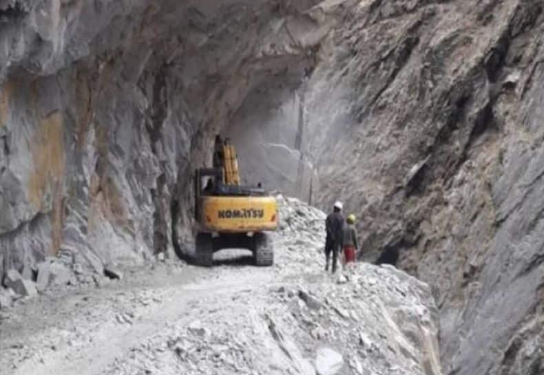
The Lipulekh route is vital for the Kailash Mansarovar pilgrimage and for border trade with Tibet. India argues that its maps, records and surveys confirm continuous governance of the region.
What Exactly Is The Border Dispute?
The dispute focuses on three locations near the India-Nepal-China tri-junction:
- Kalapani: It is controlled by India as part of Uttarakhand. Nepal says it lies east of the Kali River.
- Lipulekh: India built a road here for the Kailash Mansarovar route. Nepal claims it passes through its land.
- Limpiyadhura: Added to Nepal’s map by constitutional amendment in 2020.
In 2019, India’s new map showed Kalapani within its territory. Nepal answered with its own map a year later, covering all three areas.
What Are Nepal’s Legal, Historical Arguments?
Nepal says historical maps and documents back its sovereignty over the three areas. It argues that Indian construction and trade in Lipulekh undermine its sovereign rights.
Kathmandu has also pointed to traditional Nepali use of the land to strengthen its claim.
Why Does This Matter For India, Nepal?
For India, the Lipulekh corridor is strategic. It provides access to Tibet and serves as a pilgrimage route to Kailash Mansarovar.
For Nepal, the issue is about sovereignty and recognition of its boundaries under the Sugauli Treaty.
The dispute has surfaced repeatedly in 2015, 2020 and now in 2025. Each time, it has stirred political debate in Kathmandu and raised diplomatic friction with New Delhi.
Do Tensions Mean Hostility?
Nepal is not hostile to India, but ties have faced strain in recent years. The 2015 blockade experience made Kathmandu more wary of dependency on New Delhi. Nationalist politics in Nepal have kept the map issue alive.
Despite disputes, bonds remain. The open border continues. Millions of Nepalis live and work in India. Nepali soldiers still serve in the Indian Army. These ties endure even as the Lipulekh question remains unsettled.